
|
|
|
|
|
|
India - Pakistan - Iran - Turkey - Syria - Jordan - Lebanon - Syria - Turkey - Europe Reisverhalen, grensovergangen, de auto en de opdrachten in het Nederlands |

|
| Date | GPS | Location | Story |
| 11 - 12 June 2003 | N28°27'2.7" E81°14'27.2" |
Bardia (152 m) |
Bardia is said to be the best wildlife park of the whole subcontinent. And it is said that the pre-monsoon weeks are the best time to see tigers. But we say those pre-monsoon weeks are just bloody hot. Too bloody hot  .
After one day rest we continued West to India. .
After one day rest we continued West to India.Dutch: Welkom terug in India - nog voor de grens betalen graag... Opdracht 7 - 30.000 km gereden. |
| 10 June 2003 | N27°52'40.2" E82°29'40.7" |
Lamahi (272 m) |
A stopover on our way to Bardia. Even during the night the temperature remained above 30 degrees centigrade so no sleep for us... |
| 3 - 9 June 2003 | N29°12'54.7" E83°57'25.8" |
Pokhara (802 m) |
Pokhara has a nice campsite next to the lake. A perfect place to spent our last days in Nepal before we have to run from the monsoon rains. has a nice campsite next to the lake. A perfect place to spent our last days in Nepal before we have to run from the monsoon rains.
|
| 2 June 2003 | N27°42'48.5" E85°18'48.7" |
Kathmandu (1313 m) |
Our final day in KTM, just to pick up the Indian visa. |
| 30 May - 1 June 2003 |
N27°43'31.5" E85°31'30.9" |
Nagarkot (1936 m) |
"... and from thence went on to Venice, where Nicolo Polo found that his wife, whom he had left with child at his departure, was dead, after having delivered of a son, who received the name of Marco, and was now of the age of nineteen years." On May 31st we are travelling for just one year. Nevertheless, it feels like ages since we left Utrecht. |
| 17 - 29 May 2003 | N27°42'48.5" E85°18'48.7" |
Kathmandu (1313 m) |
Back in KTM again for doing business: extension of our Nepali visa, extension of our Carnet de Passage, obtaining the visa for India and Pakistan, and not arranging a trip to Lhasa... :-( The Chinese border is closed because of SARS! |

|
Dutch: And we are in KTM, of course, to see Edmund Hillary on the Everest 50th Anniversery celebration! |
| 9 - 16 May 2003 | N27°38'11.4" E86°13'51.2" |
Jiri (1950 m) |
The bus to Kathmandu starts from Jiri, 7 days walking through nice Sherpa villages and over fertile hills. We took the 7 o'clock Express bus to Kathmandu, but already after 3 hours driving we had to switch to a local bus because the Express bus broke down. And yes, this means buying a new ticket. Refunds because of breakdowns are unheard of... Dutch: Reisverslag van de Everest trek. |
| 6 - 8 May 2003 | N27°48'15.8" E86°42'37.1" |
Namche Bazaar (3443 m) |
The main village in the Everest area. 7 days walking from the nearest road (Jiri), 10 hours walking from the nearest airstrip (Lukla), but that's not a reason not to have 3 German Bakeries and 3 internetcafes in town! Of course, this is still Nepal, so making some pavement on the muddy streets is out of the question. Dutch: Sherpa's: rode mutsen, gele mutsen. Opdracht 26 - Teambuildingstraining voor Namche Bazaar. |
|
|||
| 1 - 5 May 2003 | N27°57'21.0" E86°47'38.8" |
Lobuche Peak (6000 m) |
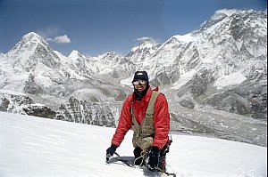
Climbing a so called "Trekking Peak" has nothing to do with trekking, but everything with ice-climbing. The climb is very tough and very cold: I got mild frostbite on four vingers due to taking pictures. The reward, however, is big. At 6000 meters and just 10 km from Mt Everest the view is unbelievable! a so called "Trekking Peak" has nothing to do with trekking, but everything with ice-climbing. The climb is very tough and very cold: I got mild frostbite on four vingers due to taking pictures. The reward, however, is big. At 6000 meters and just 10 km from Mt Everest the view is unbelievable!Dutch: Klimmen in de schaduw van Everest |
| 23 - 30 April 2003 | N27°57'14.1" E86°41'39.0" |
Gokyo (4779 m) |
Gokyo is arguably the most beautiful place of the Everest area (Sagarmatha National Park). The view from Gokyo Ri, a hill of 5366 m, is superb with four 8000 meter peaks visible from short distance. To reach Gokyo from the Everest Basecamp, we crossed the tricky but spectacular Cho La pass: walking over a glacier at 5370 meters. |
| 16 - 22 April 2003 | N28°0'25.1" E86°51'35.5" |
Everest Basecamp (5340 m) |
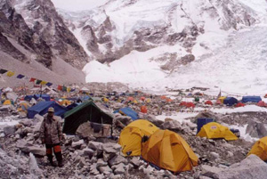
27 expeditions to Everest, 6 expeditions to neighbouring Lhotse: the 50th anniversery of the climbing of Everest makes Everest Basecamp an absurdly crowded place. With the GPS we measured a size of 500 meters for the basecamp - bigger than most European campings! |
|
Have a look at the following websites: Dutch: |
| 15 April 2003 | N27°41'22.7" E86°43'45.8" |
Lukla (2857 m) |
Uh... mountains are not airports... but Lukla is both! The airstrip goes upwards on the mountain, making landing (going up) or departing (going down) a nice rollercoaster attraction. |
| 9 - 14 April 2003 | N27°42'48.5" E85°18'48.7" |
Kathmandu (1313 m) |
Happy 2060! April 14th is New Year's Day for the Nepalis, who use a slightly different calender than we do. |
| 30 March - 8 April 2003 |
N28°5'2.6" E85°24'36.2" |
Gosainkund (4421 m) |
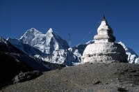
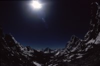
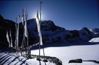
With the snowline still at 3200 meter, the trek to the holy Gosainkund lake was not easy, especially the crossing of the Laurabina pass at 4670 meter. A sinister place is the site were an Airbus of Thai Airways crashed into the mountains in 1992. Lodges at the settlement of Phedi still exhibit the purple coloured parts of the plane. From the Spitting Image manual for pilots: Mountain - despite many attempts to prove otherwise, this is not an airport... Dutch: Reisverslag van de Gosainkund trek. |
|
|
|
25 - 29 March 2003 |
N27°42'48.5" E85°18'48.7" |
Kathmandu (1313 m) |
Back again in the capital to arrange the trip to Lhasa and the climbing of the Lobuche peak. Dutch: Opdracht 6 - TATA dinky-toy gevonden in Kathmandu! |
| 24 March 2003 | N27°51'23.0" E84°33'39.6" |
Mugling (252 m) |
Massive rain and thunder caused a huge landslide on the road from Pokhara to Kathmandu. So we were forced to spend the night halfway and the next day we had to take the 8 hour diversion via Chitwan to Kathmandu. And yes, diesel was still scarce and our LandCruiser remains thirsty... |
| 22 - 23 March 2003 |
N28°12'42.2" E83°57'35.8" |
Pokhara (807 m) |
After two weeks of noodles and macaroni decent, but also bacteria-rich food again. And, not really a suprise, the second Gulf-war had started which resulted in the rationing of diesel in Nepal. Therefore we had to shop around to collect enough diesel for the way back to Kathmandu. |
| 10 - 21 March 2003 |
N28°31'50.3" E83°52'42.3" |
ABC (4130 m) |
The trek to Annapurna Basecamp (ABC) is one of the few treks in Nepal where you can reach a high altitude area in a just a few days. In March there can be still a lot of snow en route, as we experienced. en route, as we experienced.Dutch: Reisverslag van de Annapurna trek. |

|
Dutch: |
| 7 - 9 March 2003 | N28°12'42.2" E83°57'35.8" |
Pokhara (807 m) |
Pokhara is the starting point for treks to and around the Annapurna mountains. With our parents we prepared for the trek to the Annapurna Basecamp. is the starting point for treks to and around the Annapurna mountains. With our parents we prepared for the trek to the Annapurna Basecamp. |
| 1 - 7 March 2003 | N27°42'48.5" E85°18'48.7" |
Kathmandu (1313 m) |
On March 2nd both our parents arrived for a visit. We are probably the only "tour group" in KTM now, although the current talks between the Maoists and the central government give some hope of peace for the Nepalis and a return of tourists(income). Dutch: Opdracht 23 - Het GPK Guest House is niet meer. Opdracht 28 - De papies en mamies komen op bezoek. |
| Tibetan New Year Bodhnath Kathmandu |

|
||
| 24 - 28 February 2003 |
N27°42'48.5" E85°18'48.7" |
Kathmandu (1313 m) |
With Western goodies and LandCruisers available again,
our first days in KTM meant doing business for us. Info: The packing and advice list is expanded again. |
| 23 February 2003 | N27°28'42.8" E83°28'7.8" |
Sunauli (98 m) |
Sunauli, or Sonauli as it is called by the Indians, is a small village with a ramshackle gate in the center of town:
this is the border between India and Nepal. Even with a vehicle it takes only an hour to get through the customs and to obtain a visa for Nepal. Dutch: In een uurtje de grens over. |
| Picture copyright owned by Erwin Voogt. Please contact me first if you want to use any of these pictures for any purpose. |